The Pinnacle Overlook
- Kristin Holloway
- Nov 29, 2023
- 4 min read
207 Pinnacle Rd | Martic Township
This popular overlook offers a spectacular view of the Susquehanna River. The 380 foot high ridge looks over the Susquehanna River’s Lake Aldred. The main overlook is extremely popular because of it's accessibility. There is no "earning" this view. But if you follow the Conestoga Trail to the left or right of the overlook you are able to explore additional overlooks that are just as beautiful. The Overlook itself is a satellite site of the Susquehannock State Park Complex and the surrounding trials are part of the Lancaster Conservancy.

There are several trails on either side of the overlook and the Conestoga Trail crosses over the overlook and give you access to Tucquan Glen and Kelly's Run. Depending on the time of year, some of the trails can become quite overgrown. They are also very steep and rocky, but it makes for a good work out.
Distance: over 5 miles of trail
Difficulty: Medium to Well done
Terrain: dirt | rocks | grass | wooded
Activities: hiking | trail running | bird watching | leashed dogs
Parking: large parking lot
Restrooms: port-o-potty
Websites: dcnr.pa.gov lancasterconservancy.org
Orange Trail | 1 mile loop
Medium Rare | 20-40 min
This trail starts at the pull off at the end of Pinnacle Rd. before you turn right toward the overlook. It's a wide grass covered trail that cuts left into the woods about .2 miles into the hike. There is a slight increase in elevation, but nothing too challenging. There is a .35 mile shortcut that cuts through the loop and a .12 mile spur that connects to the White/Pinnacle Trail.
Blue Trail | .64 miles point to point
Medium Rare | 12-15 min
This trail begins at the same spot as the orange trail. This wide grass trail goes down hill and eventually into the woods. It crosses over the white trail and eventually connects with the Conestoga Trail.
Red Trail ( Pine Tree Trail) | .59 miles point to point
Medium | 12-15 min
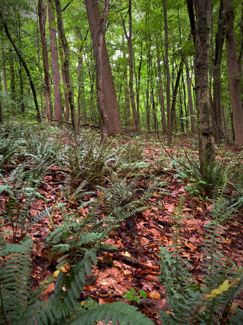
This is the first trail on the left side that you come to after the parking lot. It goes downhill and crosses over the white trail. It then connects with the Conestoga Trail. During the summer months this trail is so overgrown that it is almost impossible to get through. I recommend hiking it in fall or winter.
White Trail (Pinnacle Trail) | .46 miles point to point
Medium | 10-20 min
This trail starts .3 miles into the yellow trail. It will take you across the Red Trail and the Blue Trial and will has a connecting spur to the Orange Trail. It will then dead end when it connects to Kelly's Run.
Yellow Trail | .57 point to point
Medium Rare | 12-15 min
This trail begins to the left of the overlook. Just after it begins you have the choose between 2 trails, the yellow trail is to the left. The white trail will spur off to the left a third of a mile along the trail. The trail will come to an end when it intersects with the Conestoga Trail.
Northbound Conestoga Trail (Fire Line Trail) | .73 miles point to point
Medium Well | 20-45 min | orange trail blaze
The trail is to the left of the overlook, on the other side of the Pinnacle sign. Take the orange trail to the right. The trail starts off on a wide, level dirt path. You will then come to a fork in the trail. The yellow trail goes straight. Take the orange trial to the right, this is where the fun begins. The trail has you climbing down hill and over top of boulders. There are spectacular views of the Susquehanna along the way. You'll then come to a wide and very steep trail. The rocks are loose, which can make it difficult going down. You can take this path the whole way down and turn left at the bottom, but the actual trail cuts left a few hundred feet after you start. This will then intersect with the blue trail that will take you up to the main road.
Southbound Conestoga Trail | 1.3 miles point to point
Well Done | 40 min- 1 1/2 hrs | orange trail blazes
This trail is to the right of the overlook and starts on a wide pathway that is lined with a rock wall. The trail then cuts into the woods towards the river and will take you to a large outcropping of rocks that jut out over the Susquehanna for a spectacular view. From here you will go down a very steep dirt hill, that at times goes almost straight down. The trail takes you around a large boulder and levels out a bit, crossing over several streams. You will then climb over and even through some boulders and eventually down to the edge of Tucquan Glen.
Southbound Trail Parallel to Conestoga Trail | .6 mile point to point
Medium Well | 10-20 min
This unnamed and unmarked trial begins to the right of the overlook. It is the wide trail furthest to the right. It does run parallel to the Conestoga Trail and does intersect with it. If you see orange blazes, you are on the Conestoga Trail.
The trail starts going down a very steep hill with loose rocks. There is a trail that spurs off to the right, this will take you back to the picnic area. You will then come to a "T" in the trail.
If you go to the left the trail goes on for about .2 miles before it intersects with the Conestoga Trail. Along the way you will cross a stream that turns into a small waterfall down an embankment. The trail then cuts into the woods, away from the Conestoga Trail, finally dead ending at the railroad track.
If you go to the right, the trail forms a "u" shape before it hits private property. There is a spur off to the right when you begin this trail that will take to to the picnic area of the overlook.
Directions:
From Lancaster city go south on N. Prince St/PA 222
S Right onto PA 324 S/New Danville Pike
Left onto PA 324 S/ 741 E
At Cherry Hill Orchard go straight to continue on PA 324 S
Left on River Rd.
Right onto Pinnacle Rd.
Road dead ends at Pinnacle Overlook
Nearby Trails:


