
Conestoga Trail
- Jul 15, 2023
- 7 min read
River Hills Section | Martic Township
The Conestoga Trail System is 63 miles in length and runs from the northern part of Lancaster County, at the intersection of the Horseshoe Trail and US-322 (4 miles west of Brickerville) to the Southern end, where is crosses the Norman Wood Bridge to connect with the Mason Dixon Trail. Large parts of the trail are along rural roads and a portion goes through Lancaster County Central Park. There are several covered bridges, old mills and historic houses along the way. The trail is maintained and protected by the Lancaster Hiking Club.
This Rocky section, known as the River Hills, has been described as one of the most brutal and challenging trials in the county. I would agree with that. It's also one of the most beautiful and is well worth the sometimes soul crushing climb. This hike will take you past the Wind Cave, to House Rock Overlook, through Clark Nature Preserve, through the most picturesque portion of Tucquan Glen, up a VERY steep hill to the Pinnacle Overlook, through Kelly's Run and to an overlook of the Susquehanna at Holtwood Dam.

It's really important on this hike to be on the lookout for the orange blazes. The trail twists and turns, crosses over streams and makes some pretty sharp turns. There are spots that look like they are part of the trail, but they are not. I did this trail on my own and with a partner. I found myself losing the trail several times when I was on my own. The extra set of eyes with a partner were helpful. We also parked one vehicle at Kelly's Run (or at Rt 322) and then drove the second to Bridge Valley Road to start the hike. This is a nice option if you don't want to do the full round trip hike.
Distance: 9.9 miles point to point
Time: 4-7 hours
Terrain: dirt | rocks | water | wooded
Difficulty: Well Done/Burnt
Activities: hiking | trail running | leashed dogs
Trail Blaze: orange
Parking: Pull-off at Bridge Valley | Large Lot at Kelly's Run
Restrooms: port-o-potty at Kelly's Run and at Power Station at Holtwood Dam
Website: lancasterhikingclub.com
Bridge Valley Road to House Rock Overlook | .78 miles
Medium Well | 15- 30 min
The start of the trail is actually up Bridge Valley Road a short way past the parking area, you will see the orange blaze on a telephone pole. It takes you down an embankment and across a steam. It then takes you to the dirt road with the yellow gate in front of it. The trail picks up to the left down the dirt road a bit.
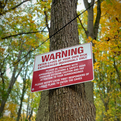
One third of a mile into the trail you will come to the Wind Cave ( aka Cold Cave). It is the largest Tectonic cave in PA. If you plan on exploring the cave make sure you are prepared with a headlamp and proper foot wear. Wind Cave Map
The trail goes up to the left of the cave entrance and takes you through a crevasse as it continues up along the ridge. There are portions of the trail that are very steep and require you to climb over rocks. There is signage to indicate when you enter House Rock Preserve. Make sure you climb up the rocks and take in the view at the overlook, it's spectacular.
House Rock Overlook through Clark Nature Preserve | 1.09 miles
Medium Well | 20-45 min
After you've seen the overlook start following the blue and orange markers that go straight along the ridge. You will soon pass the mile 8 marker for the Conestoga Trail. There is signage telling you when you leave House Rock Preserve and when you enter Reed Run Preserve. This portion of the Conestoga Trail is narrow and can get very steep at times. There are lots of roots and rocks to navigate as well. There are some lovely views of the river along this portion of the trail.
After you cross the stream (Reed Run), follow the orange markers for the Conestoga Trail to the right. The blue markers for Clark Nature Preserve's Ralph Goodno Trail goes to the left.
Clark Nature Preserve to Tucquan Glen | 1.8 miles
Medium Well | 40 min-1 hr 15 min
The trail then continues up a very steep hill. Don't miss the large rock at the top that looks like Darth Vader. You will pass the mile 7 marker for the Conestoga Trail and then map for Tucquan Glen Nature Preserve. To the right of that map you will see a narrow trail the heads toward the river. This is the old route for the Conestoga Trail and I recommend taking it. It will reconnect with the trail and it has some pretty amazing boulders and views of the river. You connect with the white Pyfer Trail and then turn down the yellow trails taking you down to the water. Once you reach the water, you will need to cross it. There are strategically placed rocks to help you across if you don't want to get your feet wet. The trail then heads uphill. Right now the trail goes around a significant portion of the rapids. Hopefully this diversion is only temporary (The Lancaster Conservancy has been doing a lot of restoration work to the trail). You are able to catch the end of the rapids. This section is very rocky and the footing is very uneven. The trail ends at the railroad tracks where you turn left and climb up the rocks to the top of the ridge.
Tucquan Glen to The Pinnacle Overlook | 1.3 miles
Well Done | 40 min- 1 1/2 hrs
The next section, in my opinion, is the most difficult of this trail. It has the greatest elevation gain and a lot of climbing over rocks. I recommend finding a nice shady spot to rest and fuel up before taking on this leg of the hike.
Continue to climb up and even through some rocks, paying attention to the trail markers because the trail does take some sharp turns. The climb is steep, but not the steepest part of this section. The trial levels out a bit and you will cross over 5 streams, depending on the rainfall.
You will then come to an enormous boulder that you will go around and then the real challenge begins. This is the toughest part of the trail and it feels like your going straight up. Once you've completed the rocky section you'll continue to ascend up a dirt trail that seems to go on forever. The reward comes when you get to an amazing overlook on an outcropping of rocks.
The trail continues up to the grassy section to Pinnacle Park and up some stairs to the "tourist" overlook. This is for those that don't want to "work" for the view. The trail then continues on the other side of the gravel road.
Pinnacle Overlook to Kelly's Run | .84 miles
Well Done | 20- 40 min
The trail continues to the left of the overlook, on the other side of the Pinnacle sign. The trail splits, with the white going to the left and the orange to the right; take the orange to the right. The trail starts off on a wide, level dirt path. You will then come to a fork in the trail. The yellow trail goes straight. Take the orange trial to the right, this is where the fun begins. The trail has you climbing down hill and over top of boulders. There are spectacular views of the Susquehanna along the way. This section of the trail always reminds me of the movie "Last of the Mohicans." I half expect Daniel Day-Lewis to come running by me.
You'll then come to a wide and very steep trail. The rocks are loose, which can make it difficult going down. You can take this path the whole way down and turn left at the bottom, but the actual trail cuts left a few hundred feet after you start. Turn right at the bottom the hill if you go that way, then turn into a boulder field, where you will scramble down the rocks to meet up with Kelly's Run. The final part of this section has you climbing down stairs made of flat rocks onto the blue trail that is the Kelly's Run Loop. From here take the trail left.
Kelly's Run to Parking Lot | 2.1 miles
Medium Well | 40 min-1 1/2 hrs
The trail will take you along Kelly's Run, crossing over it several times. At some points you will be scrambling over rocks. There are several pools that are great for wading or swimming on a hot day. The trail will then turn away from the water and head up a fairly steep and rocky hill. The wooded trail is flanked with rhododendrons and will take you through 2 power line right of ways. When you exit the woods you will be taken through Pollinator park on the way to the parking lot and the end of this portion of the trail.
Kelly's Run Parking Lot to Rt. 372 | 2 miles
To continue on the last leg of the Conestoga Trail go south of the parking lot on Old Holtwood Rd. There is a parking area on the other side of Old Holtwood Rd. at the power line right-of-way. After you cross the street the trail cuts into the woods, crossing over the power line right away several times.This section is part of Lancaster Conservancy's Holtwood Nature Preserve. After about a mile you will reach the power station for Holtwood Dam you will walk through a parking lot to Face Rock Overlook which gives you a perfect view of the Holtwood Dam. The trail then continues along the bluff along the river, giving you great views of the dam and the Norman Wood Bridge. It does get quite steep in this section. You trail takes you along a creek before you go up a steep embankment with homemade tire steps up to Rt. 372. The trail continues across the Norman Wood Bridge to Lock 12 on the other side of the Susquehanna River. But I don't recommend this. It doesn't seem very safe.
Directions to Bridge Valley Road:
From Lancaster City to south on N. Prince St/PA 222 S
Right onto PA 324 S/New Danville Pike
Left onto PA 324 S/741E
At Cherry Hill Orchard go straight to continue on PA 324S
Left onto River Rd.
Right on Bridge Valley Rd.
Pull offs are on either side of Bridge Valley Rd, just after Ridge Dr.
Look for the yellow gate and No Trespassing Signs
Directions to Kelly's Run:
US 222 S/ PA 272 S (3.7 mi).
Straight on PA 272 S/Willow Valley Pike (8.6 mi)
Right on PA 372 W
Right to stay on PA 372 W (4.8 mi)
Right onto River Road (.4 mi)
Continue on Old Holtwood Rd. to Holtwood Recreation Area
Directions from Kelly's Run to Bridge Valley Rd.
From the parking lot turn Left onto Old Holtwood Rd.
Left onto River Rd.
Left onto Delta Rd.
Continue onto West View Rd.
Right onto Bridge Valley Rd.
Nearby Hikes:
Wind Cave
Tucquan Glen


Wow, really incredible pictures!! Do you remember what month this was?