
Lancaster County Central Park
- Mar 24, 2023
- 4 min read
1050 Rockford Rd. | West Lampeter Township
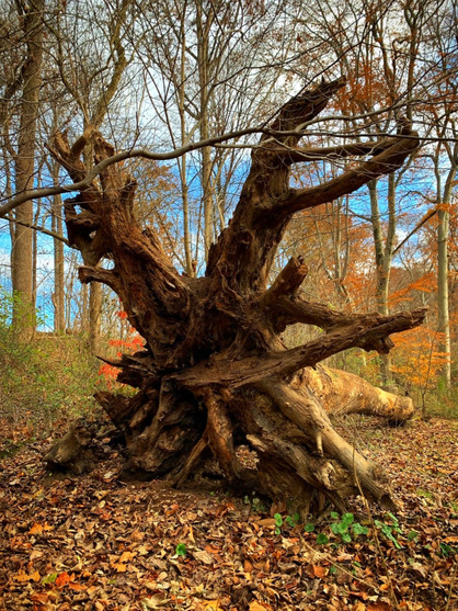
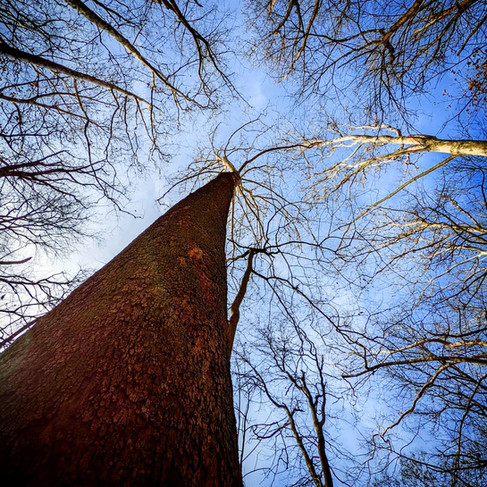
Lancaster County Central Park, named for its centralized location in the county, is the largest of the county’s parks, covering 544 acres. Central Park is located on the southern edge of Lancaster City in West Lampeter Township. The trails offer many different terrains, lengths and difficulty levels. Many of them are wooded and along bodies of water.
Along with the many hiking trials the park also has a swimming pool, skate park, gardens, pavilions, ball fields, playgrounds, camping sites and an environmental library.

This is a large park, so it is best to check the map when picking out a hike and where to park to access the hike. It is also a very busy park because of the many activities it offers and it's central location in Lancaster City. Even during the winter months I come across a number of people on the trails. If you are looking for solitude, this may not be your best bet.
Distance: over 13 miles of trials
Difficulty: rare to medium
Terrain: dirt | rocks | grass | wooded | roads
Activities: hiking | trail running | biking | leashed dogs | horseback riding | snowshoeing
Parking: large and small lots throughout the park
Restrooms: port-o-potties and restrooms (some may be seasonal)
Websites: co.lancaster.pa.us
Conestoga Trail System | 3.3 miles point to point
Medium Rare-Medium | 1- 2 hrs | orange/salmon blaze
Central Parks portion of this trail starts off on the north side of the park off of South Duke St. It follows other trails with in the park before it exists on the southern end at Golf Rd. While in the park you will pass Indian Rock, that offers a lovely vista of the Conestoga River and beyond, and Rockford Plantation, the historic home of General Edward Hand.
Conestoga Valley Association Trail (CVA Trail) | 1.8 miles point to point
Medium Rare | 30- 60 min | blue blaze
This trail starts where the Warbler Trail ends. The trail is an open grassy area that follows the Conestoga River. It goes under the Strawberry Street Bridge and crosses over Rockford Road several times. After following the river for a while the trail goes up into the woods across the street from the Rockford Plantation sign. It then follows the Conestoga Trial for a while, taking you past the Indian Rock overlook, before it ends where Rockford Rd and Williamson Rd meet for a second time.
Equestrian Trail | 3.8 miles semi-loops
1h 15 min- 2hr 30 min | signs to indicate trail
This trail is a series of 3 connecting loops. The first loop takes you around a soccer field and 2 ball fields, then follows Gold Rd to the second loop that goes around a bird nesting area, garden plots, 2 ball fields, tennis courts and follows the Fitness Trail. It then crosses Golf Rd. onto Exhibit Farm Rd. where if follows along Mill Creek. This is a grass trail that is fairly level and wide.
Fitness Trail | 1 mile loop
20-40 min | signs to indicate trail
This isn't much of a hiking trail, it's mainly for those looking to exercise. Hence the name. Along the grass trail there are stops to do different exercises. Parking for this trail can be found along Golf Rd. and West and East Farm View Dr.
Kinglet Trail | .3 mile semi-loop
6-12 min | white blaze
This little trail starts at the Garden of the Five Senses and connects with the Warbler Trail for a short distance. The trail is wooded and fairly level. There are 2 spurs the lead away from the loop, one the goes through a grove of pine trees. There are several parking areas along Rockford Rd. off of the Strawberry St. entrance.
Mill Creek Trail | 1.3 mile loop
Medium | 20- 40 min | yellow blaze
This wooded trail, located in the Kiwanis Natural Area, follows Mill Creek and will take you past the Kiwanis Club and underneath a covered bridge. Parking for this trail is at either end of Kiwanis Dr.
Scout Trail | 1.2 mile semi-loop
Medium | 25-50 min | white blaze
This wooded trail follows a portion of the Conestoga Trail. It takes you past the covered bridge and around the camping area. Some of the trail does cross over roads. Parking for this area can be found off of Nature's Way, Kiwanis Dr. (near the covered bridge), Golf Rd. and Williamson Rd.
Warbler Trail | .3 mile point to point
Medium Rare | 6-12 min | yellow blaze
This little wooded trail starts near the Garden of Five Senses and takes you through the woods where it meets the the Conestoga River and the start of the Conestoga Valley Association Trail. There are several parking areas along Rockford Rd. off of the Strawberry St. entrance.
Wildflower Trail | .4 mile point to point
Medium | 8-16 min | red blaze
This trail has 2 sections. You can pick up the first portion just after the covered bridge on Kiwanis Dr. It meanders through the woods and crosses over the closed section of Kiwanis Rd. before it connects to the Mill Creek trail. The second section, that takes you through the Muhlenburg Native Plant and Wildflower Meadow, is on the other side of mill creek and can be accessed via the Equestrian Trail off of Golf Rd or Exhibit farm Rd. This trail is the runs almost parallel to the Equestrian Trail beside an open field.
The Garden of Five Senses
This lovely little garden is perfect for everyone of all ages. It provides stimulation for all the senses and can be enjoyed all year long. There are interpretive signs along the paved walkway and in the warmer months, tranquil fountains. There is also a gazebo and picnic area. I remember going here as a kid and it is still just as magical.
Directions:
Go northwest on US-30 W
Exit toward New Holland Ave
Left onto PA-23 W/New Holland Pike
Left onto Pleasure Rd
Right onto PA-23 W/E Walnut St
Left onto N Broad St
Continue onto Chesapeake St
Left onto E Strawberry St
Continue onto Rockford Rd
Nearby Hikes:


Comments