
Abandoned PA Turnpike
- Sep 3, 2020
- 4 min read
Updated: Mar 21
3005 Pump Station Rd. | Waterfall, PA | Fulton County
Tannery Rd. and Rt 30 | Breezewood, PA | Bedford County
OUTSIDE OF LANCASTER COUNTY
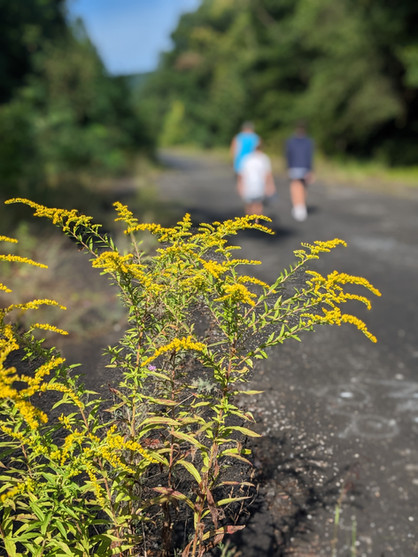
This hike requires a bit of a road trip, but is a definite must see in my book. I've always found abandoned places fascinating and I love how in the end nature always takes it back. This is a perfect example.
The Pennsylvania Turnpike was the first "super highway" in the United States when it opened in 1940. But by the 1960's the 2 lane tunnels were backing up and causing a lot of traffic jams. The most economical solution to this problem was to expand four of the tunnels with new tunnels and bypass three of the original tunnels; leaving the bypassed tunnels and 13 miles of turnpike abandoned. Today we are able to access 8.5 miles of the abandoned turnpike and 2 of the tunnels, which is known as Bike2Pike. There are plans to improve the trail, but little has been done so far.

Since not much work has been done with the turnpike or the tunnels, large portions of the road are in poor condition and the exploration of the tunnels is done at your own risk. There is lots of broken glass, sharp objects and as expected, graffiti. If you are someone who is easily offended or has young kids, this might not be the hike for you. Some of the graffiti is amazing, most is amateur and crude.
The road is fully exposed to the sun and can get hot during the summer months. However, the tunnels are cool and very dark, even in the summer. Be sure to bring a something warm to wear and a flashlight or headlamp. There is parking at either end of the trail, with a short walk to each tunnel. It is 3.8 miles between the 2 tunnels. So, if you are planning on walking, I recommend driving to each end. Going the full 17 miles out and back is more realistic if biking.
Distance: 8.5 miles point to point
Terrain: asphalt (some of which is very deteriorated)
Difficulty: medium
Activities: hiking | biking | leashed dogs
Parking: small parking lot on either end
Restrooms: no
Website: pike2bike
Sideling Hill Tunnel 1.2 miles to tunnel | 1.3 miles tunnel length
The parking lot for this side of the trail is actually part of the abandoned turnpike. There are cement barriers that you will need to go through to get to the trail. This section of the road is in rather poor condition, but it is quite level.
Shortly after you start your walk you will pass a big empty parking lot. This used to be the Cove Valley Travel Plaza. Not much remains, just an empty parking lot. You will eventually go around a bend and the tunnel will come into view. This is the longer of the 2 tunnels and once inside it is very dark and quite cold.
There is a visible trail up the hill to the right of the tunnel that gives you access to the ventilation rooms. Remember, this is not a maintained property, so portions can be quite dangerous. That being said, it is really cool!
Once you reach the other side of the tunnel you can go an additional 3.8 miles to the Rays Hill Tunnel or turn around and go back the way you came and drive to Rays Hill Tunnel.
Rays Hill Tunnel 1.5 miles to tunnel | .7 miles tunnel length
After parking in the dirt parking lot you will need to go up the hill to reach the abandoned turnpike. This section of the abandoned turnpike is in much better condition. This section was used to test rumble strips as well as training turnpike workers. It was also used in the post-apocalyptic movie "The Road." But maybe watch the movie after you visit the tunnel. After crossing a bridge the tunnel will come into view. This tunnel is about half the length of Sideling Hill, but it still pretty dark inside.
Directions:
East End | Sideling Hill From Lancaster take PA-283 W
Then take I-76 W (this is a toll road)
Take exit 180 toward US-522 S
Turn Left onto US-522 S
Turn Right onto PA-475 N/Waterfall Rd (along this road is Keller's Country Store, which is a great place to grab a sandwich for your hike)
Slight left onto N Hess Rd
Turn left onto Pump Station Rd
You will see a portion of the abandoned turnpike on the left, the road to the parking area is after this on the right. There is a mailbox and it looks like someone's driveway, but that is it.
There are also signs that say "trail parking" just before you turn. DO NOT park here. This is neighbors trying to make you pay for parking. You do not have to pay for parking.
West End | Ray's Hill Tunnel
From Lancaster take PA-283 W
Then take I-76 W (this is a toll road) Take exit 161 for I-70 E toward Breezewood
Exit onto US-30 E
Continue onto Tannery Rd.
Dirt lot at intersection of US-30 E and Tannery Rd.


Comments